

Projects
At Ewaters, we bring futuristic design, sustainability, and innovation to our clients’ projects. We strive to deliver robust solutions that meet the present needs of our clients and also pave the way for a greener, more resilient future. Whether you are a developer, stakeholder, or community member, our goal is for everyone involved in our projects to feel proud of the impact we are making on the environment. We believe that through innovation and a shared commitment to sustainability, we can look back on every project with a sense of accomplishment and confidence in the future we've helped build.
Northland Regional Council
Whangarei District Council Projects

Hikurangi Project
The Hikurangi project focuses on innovative flood forecasting techniques in Northland, enabling proactive responses to potential flood events.

Kawakawa Project
This deflection project, Kawakawa deflection bank project combines eco-friendliness with flood control, demonstrating our commitment to the environment and community resilience.
Otiria-Moerewa Project
In the Otiria-Moerewa area, we have implemented targeted flood risk reduction measures to safeguard local communities from flood threats.
Flood Forecasting
Northland region Flood Early Warning System (FEWS) to provide swift, clear flood information during severe weather for emergency responses, evacuations, and road closures.
Auckland Region Projects

Urban Flood Modeling Project
This project aims to create detailed urban catchment models for Auckland's urbanized isthmus. Through a robust methodology, the project ensures the consistent delivery of high-quality flood data that directly supports urban planning and enables more effective flood risk mitigation.

Rural Flood Modeling Project
The Regional Rural 2D Flood Modelling enhances floodplain representations by integrating advanced GIS tools and modeling technology. Using Tuflow, it employs a 4x4m grid with 1m sub-grid sampling to map flood depth, elevation, and velocity across rural Auckland.

Mill Flat Road Project
The Takanini Strategic SHA Extension at Mill Road features a water-sensitive design that suits the local landscape, the soil challenges, and flooding issues, while meeting urban design needs.
KiwiRail Projects

Morning side Project
Ewaters is actively addressing the flooding issue in the Morningside catchment of Whangarei. Kiwirail engaged Ewaters to support the resource consenting process for the new intermodal station at the Morningside Railyard. The solution not only reduced flooding in the railyard and surrounding areas but also improved water quality and created green space in a predominantly paved environment.
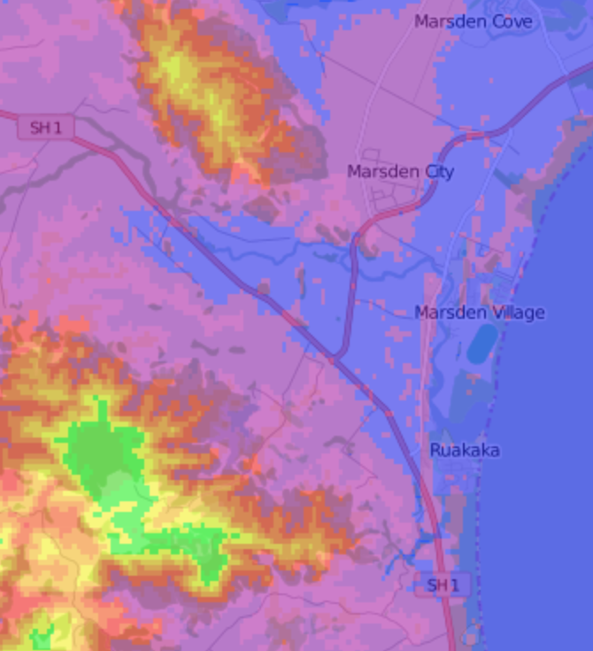
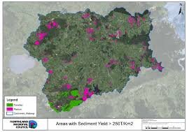
Ruakaka Project
Ruakaka River is a priority one catchment. Ewaters has been stewards for the priority rivers catchment since 2016. When Northland Regional Council directed Kiwirail to consult with Ewaters on their Marsden Point rail extension, our team converted the Ruakaka model into a validated 2D catchment model, which was then provided to Kiwirail for drainage design.

Mangapai Road Project
The Mangapai project is built on the insights gained from the Ruakaka model conversion. The Mangapai River catchment model addresses challenges posed by the causeway and intertidal conditions, ensuring effective flood and environmental management.

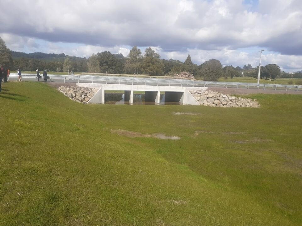
Marsden Project
The Marsden Point project incorporates UrbanThrive design principles, creating “linear wetlands” to enhance drainage and support the surrounding ecosystem along the rail alignments. These wetlands, set within ancient dunes, offer unique conditions that foster a distinct coastal ecosystem.